Precision farming is revolutionising the agricultural industry, with GPS guidance systems at the forefront of this technological transformation. These advanced tools are enabling farmers to optimise their operations, increase yields, and reduce environmental impact. By leveraging satellite technology and sophisticated software, precision agriculture is ushering in a new era of efficient and sustainable farming practices. As we delve into the world of GPS-guided precision farming, we’ll explore the cutting-edge technologies, their applications, and the profound impact they’re having on modern agriculture.
Gps-guided precision farming technologies
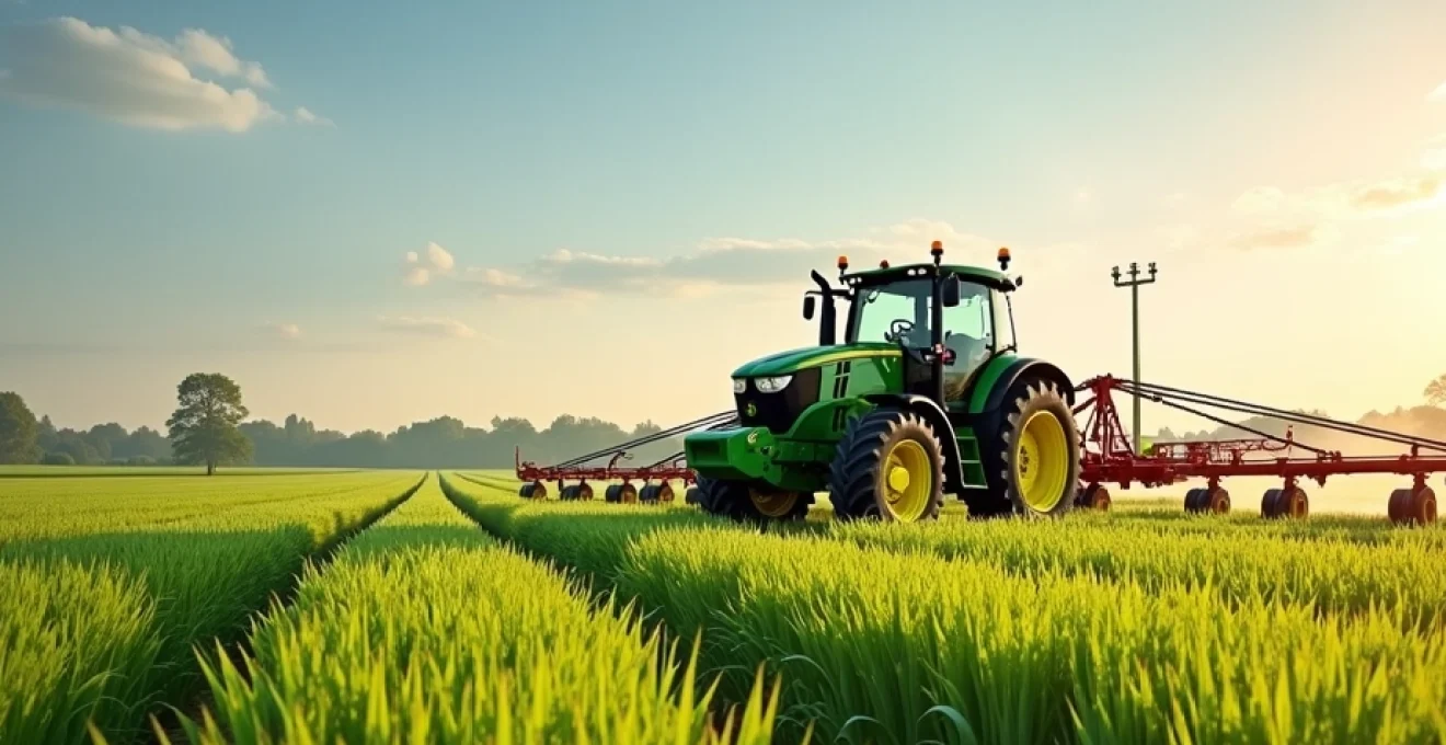
GPS guidance systems form the backbone of precision farming, providing farmers with unprecedented accuracy in their field operations. These systems use a network of satellites to determine the exact position of farm equipment, allowing for precise navigation and control. The technology has evolved rapidly, with modern systems offering sub-inch accuracy that enables farmers to plant, spray, and harvest with remarkable precision.
One of the primary benefits of GPS guidance in agriculture is the reduction of input overlap. By precisely guiding tractors and other machinery, farmers can minimise wastage of seeds, fertilisers, and pesticides. This not only reduces costs but also lessens the environmental impact of farming activities. Additionally, GPS guidance systems help reduce operator fatigue, allowing for longer working hours and increased productivity.
Another key application of GPS technology in precision farming is the creation of detailed field maps. These maps can show variations in soil type, nutrient levels, and crop yield across a field, allowing farmers to make data-driven decisions about resource allocation. By understanding the specific needs of different areas within a field, farmers can optimise their inputs and maximise their outputs.
RTK base stations and centimeter-level accuracy
Real-Time Kinematic (RTK) technology has taken GPS guidance to new heights, offering centimeter-level accuracy that is crucial for many precision farming applications. RTK systems use a fixed base station in combination with mobile GPS receivers on farm equipment to achieve this high level of precision. The base station broadcasts correction data to the mobile receivers, allowing them to calculate their position with incredible accuracy.
NTRIP protocol for network-based corrections
The Networked Transport of RTCM via Internet Protocol (NTRIP) has emerged as a key technology for delivering RTK corrections to farm equipment. NTRIP allows for the streaming of GPS correction data over the internet, eliminating the need for a dedicated radio link between the base station and the mobile receiver. This protocol has greatly increased the flexibility and range of RTK systems, making high-precision GPS guidance more accessible to farmers.
Single-base vs. network RTK solutions
Farmers have the option of choosing between single-base and network RTK solutions. Single-base systems use a dedicated base station located on or near the farm, providing highly accurate corrections within a limited range. Network RTK solutions, on the other hand, use a network of base stations spread across a wider area, offering broader coverage and increased reliability. The choice between these options depends on factors such as farm size, terrain, and available infrastructure.
Trimble RTX and john deere StarFire: satellite-based augmentation
For farmers who require high accuracy but may not have access to RTK networks, satellite-based augmentation systems (SBAS) offer an alternative solution. Technologies like Trimble RTX and John Deere StarFire provide centimeter-level accuracy without the need for local base stations. These systems use a network of ground stations and geostationary satellites to broadcast correction data, enabling precise positioning across large areas.
Multi-constellation GNSS receivers for enhanced reliability
Modern GPS guidance systems in agriculture often incorporate multi-constellation Global Navigation Satellite System (GNSS) receivers. These advanced receivers can utilise signals from multiple satellite networks, including GPS, GLONASS, Galileo, and BeiDou. By tapping into multiple constellations, these systems offer improved reliability and accuracy, especially in challenging environments such as areas with limited sky view or during periods of atmospheric interference.
Variable rate application (VRA) in precision agriculture
Variable Rate Application (VRA) technology is a cornerstone of precision agriculture, allowing farmers to apply inputs such as fertilisers, seeds, and pesticides at varying rates across a field. This targeted approach ensures that each area of the field receives the optimal amount of inputs based on its specific needs, leading to improved efficiency and reduced waste.
Prescription maps and georeferenced soil sampling
The foundation of effective VRA is accurate prescription maps. These maps are created using a combination of historical yield data, soil sampling results, and other field observations. Georeferenced soil sampling, where soil samples are taken at precise GPS coordinates, provides valuable information about soil nutrient levels and other properties. This data is then used to create detailed prescription maps that guide the application of inputs across the field.
ISOBUS compatibility for implement control
ISOBUS (ISO 11783) is an international standard that allows for seamless communication between tractors, implements, and farm management software. This compatibility is crucial for VRA, as it enables precise control of equipment such as seeders, sprayers, and fertiliser spreaders. ISOBUS-compatible systems can automatically adjust application rates based on prescription maps and real-time sensor data, ensuring optimal input use across the field.
Section control and individual nozzle shutoff systems
Section control technology takes VRA to the next level by allowing farmers to control individual sections or even individual nozzles on sprayers and other application equipment. This fine-grained control minimises overlap and ensures that inputs are applied only where needed, even in irregularly shaped fields or when working around obstacles. The result is significant reductions in input costs and environmental impact.
Machine learning algorithms for real-time VRA optimization
The integration of machine learning algorithms is pushing the boundaries of VRA technology. These advanced systems can analyse real-time data from sensors on farm equipment, combine it with historical data and environmental factors, and make instant decisions about optimal application rates. This dynamic approach to VRA allows for even greater precision and efficiency, adapting to changing conditions in real-time.
Autonomous guidance systems and robotics in farming
The evolution of GPS guidance systems has paved the way for autonomous and robotic farming solutions. These cutting-edge technologies are transforming agricultural operations, offering increased efficiency, precision, and the potential to address labour shortages in the farming sector.
Path planning algorithms for optimal field coverage
Advanced path planning algorithms are at the heart of autonomous guidance systems. These algorithms calculate the most efficient routes for farm equipment to cover a field, taking into account factors such as field shape, obstacles, and the turning radius of the machinery. By optimising field coverage, these systems can significantly reduce fuel consumption, minimise soil compaction, and increase overall operational efficiency.
Sensor fusion for obstacle detection and avoidance
Safety is paramount in autonomous farming operations. To ensure safe operation, autonomous guidance systems employ a technique called sensor fusion, which combines data from multiple sensors such as cameras, LiDAR, and radar. This comprehensive approach to obstacle detection allows autonomous farm equipment to identify and avoid potential hazards, from stationary objects to moving animals or people.
Caseih AFS AccuGuide and new holland IntelliSteer: autosteering solutions
Major agricultural equipment manufacturers are leading the way in autonomous guidance technology. Systems like CaseIH AFS AccuGuide and New Holland IntelliSteer offer advanced autosteering capabilities that can be integrated with a wide range of farm equipment. These systems provide hands-free operation with centimeter-level accuracy, allowing farmers to focus on monitoring and optimising overall farm operations rather than manually steering equipment.
Data management and farm information systems
The proliferation of precision farming technologies has led to an explosion of data in agriculture. Effective management and analysis of this data are crucial for maximising the benefits of precision farming techniques. Farm information systems have evolved to meet this challenge, offering powerful tools for data collection, storage, analysis, and decision-making.
Cloud-based platforms: climate FieldView and farmers edge
Cloud-based farm management platforms have emerged as essential tools for modern precision agriculture. Services like Climate FieldView and Farmers Edge offer comprehensive solutions for data management, analysis, and decision support. These platforms can integrate data from various sources, including GPS-guided equipment, weather stations, and satellite imagery, providing farmers with a holistic view of their operations and actionable insights for improving productivity.
API integration for seamless data transfer
Application Programming Interfaces (APIs) play a crucial role in modern farm information systems. APIs allow for seamless data transfer between different software and hardware components, enabling farmers to create a customised ecosystem of precision farming tools. This interoperability ensures that data from GPS guidance systems, VRA equipment, and other precision technologies can be easily integrated and analysed, maximising the value of the information collected.
Precision agriculture data standards: ISOXML and ADAPT
To facilitate data exchange and interoperability between different precision farming systems, industry standards such as ISOXML and ADAPT have been developed. ISOXML (ISO 11783) provides a standardised format for exchanging data between farm equipment and management software. The Agricultural Data Application Programming Toolkit (ADAPT) framework, developed by AgGateway, aims to simplify data exchange between different precision agriculture systems, reducing the complexity of integrating multiple technologies.
Economic impact and ROI of GPS guidance systems
The adoption of GPS guidance systems and other precision farming technologies represents a significant investment for farmers. However, the potential return on investment (ROI) can be substantial, with benefits ranging from reduced input costs to increased yields and improved operational efficiency.
Input cost reduction through precision application
One of the most immediate and measurable benefits of GPS guidance systems is the reduction in input costs. By minimising overlap and enabling precise application of seeds, fertilisers, and pesticides, these systems can significantly reduce waste. Studies have shown that farmers can achieve savings of up to 15% on input costs through the use of precision application technologies, translating to substantial financial benefits, especially for large-scale operations.
Yield improvements from reduced compaction and overlap
GPS guidance systems contribute to yield improvements in several ways. By reducing soil compaction through optimised traffic patterns and minimising overlap in planting and spraying operations, these systems create better conditions for crop growth. Additionally, the ability to precisely place seeds and apply inputs at variable rates based on field conditions can lead to more uniform crop development and higher overall yields. Farmers using precision agriculture techniques have reported yield increases of 3-10%, depending on the crop and specific technologies employed.
Labor efficiency gains and extended operating hours
The automation provided by GPS guidance systems can significantly improve labour efficiency on the farm. Autosteering technology reduces operator fatigue, allowing for longer working hours and increased productivity. This is particularly valuable during critical planting and harvesting periods when time is of the essence. Furthermore, the precision offered by these systems enables less experienced operators to perform complex tasks with a high degree of accuracy, addressing some of the challenges associated with skilled labour shortages in agriculture.
In conclusion, GPS guidance systems and related precision farming technologies are transforming modern agriculture. From centimeter-level accuracy in field operations to data-driven decision-making, these innovations are enabling farmers to optimise their operations, reduce costs, and improve yields. As the technology continues to evolve, with advancements in autonomous systems and artificial intelligence, the future of precision agriculture looks promising, offering the potential for even greater efficiency and sustainability in farming practices.