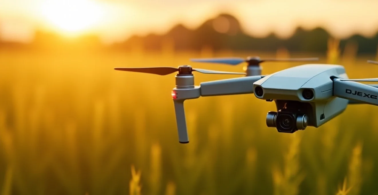
The agricultural landscape is undergoing a profound transformation, with drone technology at the forefront of this revolution. From precision crop monitoring to automated spraying systems, drones are reshaping farming practices and ushering in a new era of efficiency and sustainability. As farmers face increasing pressure to optimise yields while minimising environmental impact, these aerial marvels offer solutions that were once the stuff of science fiction.
Drones equipped with advanced sensors and imaging capabilities are providing farmers with unprecedented insights into their fields, enabling data-driven decision-making on a scale never before possible. This technological leap is not just about gadgets in the sky; it’s about fundamentally changing how we approach food production in the 21st century.
Precision agriculture revolution: drone technology integration
The integration of drone technology in agriculture marks a significant milestone in the evolution of farming practices. Precision agriculture, powered by drones, allows farmers to monitor and manage their crops with pinpoint accuracy. This level of precision enables the optimisation of resources, reduction of waste, and improvement of overall farm productivity.
Drones equipped with high-resolution cameras and specialised sensors can survey vast areas of farmland in a fraction of the time it would take to do so on foot or by vehicle. This efficiency translates into real-time data collection, enabling farmers to make informed decisions quickly and effectively.
One of the most significant advantages of drone integration is the ability to identify issues before they become visible to the naked eye. Early detection of pest infestations, nutrient deficiencies, or water stress can mean the difference between a bumper crop and a failed harvest. This proactive approach to farm management is revolutionising the way farmers interact with their land and crops.
Multispectral imaging for crop health assessment
At the heart of drone-based precision agriculture lies multispectral imaging technology. This advanced form of remote sensing allows farmers to see beyond what’s visible to the human eye, providing crucial insights into crop health and vitality.
NDVI analysis using DJI phantom 4 multispectral
The DJI Phantom 4 Multispectral is a game-changer in the field of agricultural drones. This sophisticated device utilises Normalized Difference Vegetation Index (NDVI) analysis to assess crop health with remarkable accuracy. NDVI measures the difference between near-infrared light reflected by vegetation and red light absorbed by it, providing a numerical indicator of plant health and density.
By flying over fields and capturing multispectral images, the Phantom 4 Multispectral enables farmers to create detailed NDVI maps. These maps highlight areas of stress or poor growth, allowing for targeted interventions. The precision of this technology means that farmers can address issues at a micro-level, potentially saving entire crops from widespread problems.
Thermal imaging with FLIR vue pro R for water stress detection
Water management is a critical aspect of modern agriculture, and thermal imaging drones are proving to be invaluable tools in this arena. The FLIR Vue Pro R, when mounted on a drone, provides farmers with thermal maps of their fields, revealing temperature variations that can indicate water stress or irrigation issues.
This technology allows for the early detection of drought conditions or inefficient irrigation systems. By identifying areas of heat stress, farmers can adjust their watering strategies to ensure optimal crop hydration. The ability to visualise water distribution across fields leads to more efficient use of this precious resource, reducing waste and improving crop resilience.
Hyperspectral sensors for early disease identification
Hyperspectral imaging takes crop analysis to an even more sophisticated level. These sensors can detect subtle changes in plant tissue that may indicate the onset of disease, often before any visible symptoms appear. By capturing data across a wide range of the electromagnetic spectrum, hyperspectral sensors provide a wealth of information about crop health and potential threats.
Early disease identification is crucial for effective crop management. With hyperspectral imaging, farmers can spot the signs of fungal infections, bacterial diseases, or viral outbreaks in their infancy. This early warning system allows for targeted treatment, potentially saving entire fields from devastating crop losses.
Machine learning algorithms for spectral data interpretation
The vast amount of data collected by multispectral and hyperspectral sensors would be overwhelming without advanced interpretation tools. This is where machine learning algorithms come into play, transforming raw spectral data into actionable insights for farmers.
These algorithms can analyse patterns in the spectral data, identifying anomalies that might indicate crop stress or disease. As the algorithms learn from more data, their accuracy in predicting crop health issues improves. This artificial intelligence approach to data interpretation is revolutionising how farmers understand and respond to the needs of their crops.
Machine learning in agriculture is not just about data analysis; it’s about creating a new paradigm of intelligent farming where decisions are driven by predictive insights rather than reactive measures.
Automated spraying systems and variable rate application
The evolution of drone technology in agriculture has led to the development of sophisticated automated spraying systems. These systems represent a significant leap forward in precision and efficiency, allowing for targeted application of pesticides, herbicides, and fertilisers.
DJI agras T30 for precision pesticide application
The DJI Agras T30 is a prime example of how drone technology is revolutionising crop spraying. This powerful agricultural drone can carry up to 30 litres of liquid payload, making it suitable for treating large areas efficiently. Its precision spraying capabilities ensure that pesticides are applied exactly where they’re needed, reducing waste and minimising environmental impact.
Equipped with advanced obstacle avoidance systems and real-time terrain following, the Agras T30 can navigate complex field layouts with ease. This level of automation not only improves safety but also allows for spraying in areas that might be challenging or dangerous for traditional ground-based equipment.
Yamaha RMAX for Large-Scale crop dusting operations
For larger operations, the Yamaha RMAX represents the cutting edge of unmanned aerial crop dusting. This robust helicopter drone is designed for heavy-duty agricultural work, capable of spraying or seeding over vast areas. With a payload capacity of up to 28 kg, the RMAX can tackle substantial farming tasks with impressive efficiency.
The RMAX’s ability to cover large areas quickly makes it an invaluable tool for time-sensitive operations such as pest control or fertiliser application. Its use in agriculture has shown significant reductions in chemical usage while improving overall crop health and yield.
Gps-guided spraying patterns and dosage control
One of the most significant advantages of drone-based spraying systems is their ability to follow precise, GPS-guided patterns. This ensures complete coverage of the target area without overlap or missed spots, a common issue with manual spraying methods.
Additionally, these systems can adjust spray dosage in real-time based on factors such as flight speed, altitude, and wind conditions. This dynamic dosage control ensures that the right amount of product is applied consistently across the field, optimising usage and reducing the risk of over-application.
Integration with john deere operations center for data management
The true power of automated spraying systems is realised when they’re integrated with comprehensive farm management platforms like the John Deere Operations Center. This integration allows for seamless data flow between drones, tractors, and other farm equipment, creating a unified system for precision agriculture.
By combining drone-collected data with historical field information and real-time equipment data, farmers can make more informed decisions about when, where, and how to apply inputs. This holistic approach to farm management is driving significant improvements in efficiency and sustainability across the agricultural sector.
Drone-based mapping and field analysis
Drone technology has revolutionised field mapping and analysis, providing farmers with detailed insights into their land that were previously impossible to obtain. These aerial surveys offer a bird’s-eye view of crops, soil conditions, and topography, enabling precise planning and management strategies.
High-resolution orthomosaic creation using sensefly ebee X
The senseFly eBee X is a professional mapping drone that excels in creating high-resolution orthomosaic maps of agricultural land. These detailed aerial images are stitched together to form a comprehensive, geometrically corrected map that provides an accurate representation of the land surface.
Orthomosaic maps created by the eBee X offer unprecedented detail, allowing farmers to identify issues such as plant stand problems, weed infestations, or drainage issues with remarkable clarity. This level of visual precision enables targeted interventions and more effective land management strategies.
3D terrain modeling for drainage planning
Drones equipped with LiDAR (Light Detection and Ranging) sensors can create highly accurate 3D models of field terrain. These models are invaluable for understanding the topography of farmland and planning effective drainage systems.
By analysing these 3D terrain models, farmers can identify low-lying areas prone to water accumulation, plan the optimal placement of drainage tiles, and design contour-based planting patterns. This proactive approach to water management can significantly reduce the risk of crop loss due to flooding or poor drainage.
Crop yield estimation through AI-powered image analysis
Artificial Intelligence (AI) is transforming the way drone-captured images are analysed for crop yield estimation. By processing high-resolution aerial images, AI algorithms can count plants, assess crop health, and predict yield with remarkable accuracy.
This technology allows farmers to make data-driven decisions about harvest timing, storage requirements, and market planning. Early yield estimates can also help in negotiating contracts with buyers and planning logistics for the harvest season.
Pix4dfields software for actionable insights generation
Pix4Dfields is a powerful software tool designed specifically for agricultural drone mapping. It transforms drone-captured images into actionable insights, enabling farmers to make informed decisions about crop management.
The software can generate various types of maps, including NDVI, thermal, and RGB (visible light) maps. These can be used to assess plant health, identify areas of stress, and track crop development over time. Pix4Dfields also allows for the creation of prescription maps for variable rate applications, further enhancing the precision of farming operations.
The integration of drone mapping with sophisticated analysis software is not just improving farm efficiency; it’s fundamentally changing how we understand and interact with agricultural landscapes.
Regulatory framework and compliance for agricultural drones
As the use of drones in agriculture continues to grow, navigating the regulatory landscape becomes increasingly important. Farmers and drone operators must be aware of and comply with various regulations governing the use of unmanned aerial vehicles (UAVs) in agricultural settings.
In the United Kingdom, the Civil Aviation Authority (CAA) is responsible for regulating the use of drones. Agricultural drone operators must obtain the appropriate permissions and certifications, which may include a General Visual Line of Sight Certificate (GVC) for operations in the ‘specific’ category.
Compliance with data protection laws is also crucial, especially when capturing images or data that may include private property or individuals. Farmers using drones must ensure they have appropriate protocols in place for data handling and storage to protect privacy and comply with GDPR regulations.
Additionally, there are specific regulations regarding the aerial application of pesticides and other chemicals. In the UK, operators must obtain a Civil Aviation Authority (CAA) permission and comply with the Control of Pesticides Regulations 1986. These regulations ensure that drone spraying operations are conducted safely and with minimal environmental impact.
Economic impact and ROI analysis of drone adoption in farming
The adoption of drone technology in agriculture represents a significant investment for farmers, but the potential return on investment (ROI) can be substantial. To understand the economic impact, it’s essential to consider both the direct cost savings and the potential for increased yields and efficiency.
Initial costs for agricultural drones can range from a few thousand pounds for basic models to tens of thousands for advanced systems with specialised sensors and spraying capabilities. However, these costs should be weighed against the potential benefits:
- Reduced input costs through precision application of fertilisers and pesticides
- Labour savings from automated surveying and spraying operations
- Increased yields through early detection and treatment of crop issues
- Improved crop quality leading to higher market prices
- Long-term soil health benefits from more precise management practices
A study by PwC estimated that the market for drone-powered solutions in agriculture could reach $32.4 billion globally. This figure underscores the significant economic potential of drone technology in the farming sector.
Farmers considering drone adoption should conduct a thorough ROI analysis, taking into account their specific crop types, farm size, and current management practices. In many cases, the initial investment can be recouped within a few growing seasons, with ongoing benefits accruing over time.
Future trends: swarm technology and AI-driven autonomous operations
The future of agricultural drones is moving towards even greater autonomy and coordination, with swarm technology and advanced AI systems leading the way. These developments promise to further revolutionise farming practices, making them more efficient, precise, and sustainable.
Intel’s shooting star drones for coordinated field operations
Intel’s Shooting Star drones, while primarily known for their light shows, represent the potential for coordinated drone swarms in agriculture. Imagine a fleet of drones working in concert to survey, spray, or monitor vast areas of farmland with unprecedented speed and accuracy.
This swarm technology could allow for rapid response to localised issues, with multiple drones converging on problem areas to provide comprehensive data or targeted treatment. The coordination of drone swarms through centralised AI systems could dramatically increase the efficiency of large-scale farming operations.
Edge computing for real-time decision making in flight
Edge computing is set to play a crucial role in the future of agricultural drones. By processing data on-board the drone itself, rather than relying on cloud-based systems, edge computing enables real-time decision making and faster response times.
This capability could allow drones to make autonomous decisions about spraying, imaging, or other operations based on real-time sensor data. For example, a drone could adjust its spraying pattern mid-flight in response to detected changes in crop health or wind conditions.
Integration with IoT sensors and smart farming ecosystems
The integration of drones with IoT (Internet of Things) sensors and broader smart farming ecosystems represents the next frontier in precision agriculture. Drones could serve as mobile data collection and action platforms, working in tandem with ground-based sensors and automated farming equipment.
This interconnected system would allow for a holistic approach to farm management, with drones acting on data from soil moisture sensors, weather stations, and crop monitoring systems. The result would be a highly responsive and efficient farming operation, capable of optimising resource use and maximising yields.
Blockchain technology for drone data security and traceability
As agricultural drones collect and process increasingly sensitive data, ensuring the security and traceability of this information becomes paramount. Blockchain technology offers a potential solution, providing a secure and transparent way to store and verify drone-collected data.
Implementing blockchain in agricultural drone systems could enhance data integrity, improve traceability in the food supply chain, and enable more transparent and efficient farm management practices. This technology could also facilitate the development of new business models, such as data marketplaces where farmers can monetise the insights gathered by their drones.
The future of agricultural drones is bright, with ongoing innovations promising to further transform farming practices. As these technologies mature and become more accessible, they have the potential to address some of the most pressing challenges in global agriculture, from food security to environmental sustainability.
The convergence of drone technology, AI, IoT, and blockchain is not just an technological evolution; it’s a agricultural revolution that will reshape how we produce food for generations to come.
As we look to the future, it’s clear that drones will play an increasingly central role in modern agriculture. From precision monitoring and targeted interventions to autonomous operations and data-driven decision making, these aerial tools are set to become as essential to farming as the tractor or the plough. The ongoing development of more sophisticated, AI-driven systems promises to unlock even greater potential, pushing the boundaries of what’s possible in agricultural efficiency and sustainability.
As we continue to explore the future of agricultural drones, it’s clear that the integration of advanced technologies will play a crucial role in shaping farming practices. The convergence of artificial intelligence, Internet of Things (IoT), and blockchain technology with drone systems promises to unlock new levels of efficiency and precision in agriculture.
Edge computing for real-time decision making in flight
Edge computing is set to revolutionize the capabilities of agricultural drones by enabling on-board data processing and real-time decision making. This technological advancement allows drones to analyze and act upon sensor data without relying on cloud-based systems, significantly reducing latency and improving response times.
With edge computing, drones can make instantaneous adjustments to their operations based on real-time environmental conditions. For example, a spraying drone equipped with edge computing capabilities could:
- Adjust spray patterns in response to sudden wind changes
- Modify application rates based on real-time crop health assessments
- Avoid obstacles or protected areas without human intervention
This level of autonomous decision-making not only enhances the efficiency of drone operations but also improves the precision of agricultural interventions. By processing data on the fly, edge computing enables drones to respond to the dynamic nature of agricultural environments, ensuring that every action taken is optimized for current conditions.
Integration with IoT sensors and smart farming ecosystems
The true potential of agricultural drones is realized when they are integrated into broader smart farming ecosystems. By connecting drones with IoT sensors scattered across fields, farmers can create a comprehensive network of data collection and analysis tools that work in harmony to optimize every aspect of crop production.
In this integrated system, drones serve as mobile data hubs, collecting and correlating information from various sources:
- Ground-based soil moisture sensors
- Weather stations providing real-time atmospheric data
- Crop monitoring systems tracking growth patterns and health indicators
- Smart irrigation systems managing water distribution
The synergy between drones and IoT sensors allows for a more nuanced and responsive approach to farm management. For instance, a drone conducting a routine survey might detect signs of water stress in a particular section of the field. This information, when combined with data from soil moisture sensors and weather forecasts, can trigger an automated response from the irrigation system, ensuring that water is delivered precisely where and when it’s needed.
Moreover, this integration enables predictive modeling on a scale previously unattainable. By analyzing patterns in the collected data, AI systems can forecast potential issues before they become visible, allowing farmers to take preemptive action to protect their crops.
Blockchain technology for drone data security and traceability
As agricultural drones become more sophisticated in their data collection and analysis capabilities, ensuring the security and integrity of this data becomes paramount. Blockchain technology offers a robust solution to this challenge, providing a decentralized and tamper-proof system for storing and verifying drone-collected information.
Implementing blockchain in agricultural drone systems offers several key benefits:
- Enhanced data integrity: Every piece of information collected by drones is cryptographically sealed, making it virtually impossible to alter without detection.
- Improved traceability: The entire history of data collection, from field to final product, can be transparently tracked and verified.
- Facilitation of data marketplaces: Farmers can securely monetize their data, creating new revenue streams while contributing to broader agricultural research and development.
- Compliance and certification: Blockchain can simplify the process of proving compliance with organic farming standards or other certifications.
By leveraging blockchain technology, agricultural drone systems can provide an unprecedented level of trust and transparency in the food supply chain. Consumers can trace the journey of their food from seed to table, while farmers gain a powerful tool for demonstrating the quality and sustainability of their practices.
The integration of blockchain with agricultural drone systems is not just about securing data; it’s about creating a new paradigm of trust and transparency in food production that benefits everyone from farmers to consumers.
As we look to the future, the convergence of drone technology with edge computing, IoT integration, and blockchain security promises to revolutionize agriculture in ways we’re only beginning to imagine. These advancements will enable farmers to make more informed decisions, optimize resource use, and produce food more sustainably and efficiently than ever before.
The agricultural drone of tomorrow will be more than just a flying sensor or sprayer; it will be an intelligent, autonomous agent working in concert with a network of smart devices to manage farms with unprecedented precision and insight. As these technologies mature and become more accessible, they have the potential to address some of the most pressing challenges in global agriculture, from food security to environmental sustainability.
In conclusion, the future of agricultural drones is bright and full of potential. As we continue to innovate and integrate these technologies, we’re not just improving farming practices; we’re reimagining the very nature of agriculture for the 21st century and beyond. The drone revolution in farming is just beginning, and its impact on how we grow, manage, and produce food will be felt for generations to come.