The agricultural landscape is undergoing a revolutionary transformation with the integration of drone technology for field surveillance. Precision agriculture, powered by advanced aerial systems, is reshaping how farmers monitor, analyze, and manage their crops. These unmanned aerial vehicles (UAVs) equipped with cutting-edge sensors and imaging systems are providing unprecedented insights into field conditions, crop health, and resource management. By leveraging real-time data processing and artificial intelligence, drones are enabling farmers to make more informed decisions, optimize resource allocation, and ultimately increase yields while reducing environmental impact.
Precision agriculture revolution: drone technology integration
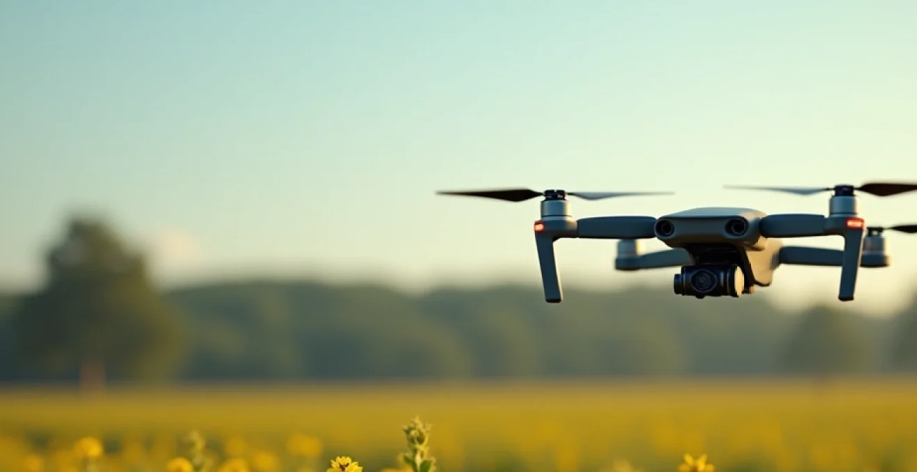
The adoption of drones in agriculture marks a significant leap forward in farming practices. These aerial platforms offer a bird’s-eye view of vast agricultural lands, allowing farmers to monitor crop development, detect issues, and implement targeted interventions with remarkable efficiency. The integration of drone technology in field surveillance has revolutionized the way farmers approach crop management, soil analysis, and pest control.
Drones equipped with high-resolution cameras and specialized sensors can cover large areas quickly, providing detailed imagery and data that would be impractical or impossible to collect through traditional ground-based methods. This aerial perspective enables farmers to identify problems such as nutrient deficiencies, pest infestations, or irrigation issues before they become visible to the naked eye , allowing for early intervention and potentially saving entire crops.
Moreover, the precision offered by drone technology significantly reduces the need for blanket applications of fertilizers, pesticides, and water. By targeting only the areas that require attention, farmers can minimize waste, reduce costs, and lessen the environmental impact of their operations. This level of precision not only improves the efficiency of farm management but also contributes to more sustainable agricultural practices.
Advanced sensors and imaging systems for field analysis
The power of drone technology in agriculture lies in the sophisticated sensors and imaging systems they carry. These advanced tools provide farmers with a wealth of data about their fields, enabling them to make data-driven decisions with unprecedented accuracy.
Multispectral imaging with parrot sequoia+ sensor
Multispectral imaging has become a game-changer in crop health assessment. The Parrot Sequoia+ sensor, for instance, captures data across multiple spectral bands, including visible and near-infrared light. This technology allows farmers to calculate vegetation indices such as the Normalized Difference Vegetation Index (NDVI), which provides crucial information about crop vigor and stress levels.
By analyzing the reflectance patterns of crops in different light spectrums, multispectral imaging can reveal:
- Plant stress before visible symptoms appear
- Variations in crop growth across a field
- Areas of nutrient deficiency or excess
- Early signs of pest infestation or disease
This level of detail allows for targeted interventions, optimizing resource use and potentially increasing yields by up to 20% in some cases.
Thermal mapping using FLIR vue pro R camera
Thermal imaging adds another layer of insight to field surveillance. The FLIR Vue Pro R camera, when mounted on a drone, can detect temperature variations across a field. This capability is invaluable for:
- Identifying irrigation issues and water stress
- Detecting soil moisture variations
- Locating underground drainage problems
- Monitoring crop maturity and harvest readiness
Thermal mapping enables farmers to pinpoint areas of concern with exceptional accuracy, allowing for precise adjustments to irrigation systems and helping to prevent crop loss due to water stress or overwatering.
Lidar technology for 3D field modeling
Light Detection and Ranging (LiDAR) technology has opened up new possibilities in field mapping and analysis. When integrated into drone systems, LiDAR sensors create highly accurate 3D models of agricultural landscapes. These models provide valuable information about:
- Field topography and slope
- Crop height and density
- Soil erosion patterns
- Drainage and water flow
The precision of LiDAR data allows farmers to optimize field layouts, plan drainage systems, and even predict potential problem areas before they develop. This technology is particularly useful in precision agriculture, where every centimeter counts in maximizing crop yields and minimizing resource waste.
Hyperspectral imaging with headwall Nano-Hyperspec
Taking spectral analysis to the next level, hyperspectral imaging systems like the Headwall Nano-Hyperspec provide an incredibly detailed view of crop and soil conditions. These sensors capture data across hundreds of spectral bands, offering unparalleled insights into:
- Crop biochemistry and physiology
- Soil composition and organic matter content
- Early detection of plant diseases
- Precise identification of weed species
The wealth of data provided by hyperspectral imaging allows for highly targeted crop management strategies, potentially reducing pesticide use by up to 30% and improving overall crop quality.
Real-time data processing and AI-Driven insights
The true power of drone-based field surveillance lies not just in data collection, but in the ability to process and analyze this data in real-time. Advanced computing systems and artificial intelligence algorithms are transforming raw sensor data into actionable insights, enabling farmers to make informed decisions on the fly.
Edge computing with DJI manifold 2
Edge computing platforms like the DJI Manifold 2 bring processing power directly to the drone, allowing for real-time data analysis and decision-making. This on-board processing capability enables:
- Immediate detection of crop anomalies
- Real-time adjustment of flight paths for optimal coverage
- Instant generation of prescription maps for variable rate applications
- Reduced data transfer and storage requirements
By processing data at the edge, farmers can receive actionable insights while the drone is still in flight, dramatically reducing the time between data collection and implementation of management decisions.
Machine learning algorithms for crop health assessment
Artificial intelligence, particularly machine learning algorithms, is revolutionizing the interpretation of drone-collected data. These sophisticated systems can analyze vast amounts of multispectral and hyperspectral imagery to:
- Automatically classify crop types and growth stages
- Detect and quantify pest infestations
- Predict yield potential with increasing accuracy
- Identify nutrient deficiencies based on subtle spectral signatures
As these AI systems learn from more data over time, their accuracy and predictive capabilities continue to improve, providing farmers with ever more reliable and actionable insights.
Integration with farm management software (FMS)
The seamless integration of drone-collected data with comprehensive Farm Management Software (FMS) platforms is creating a new paradigm in precision agriculture. This integration allows for:
- Centralized storage and analysis of historical field data
- Correlation of drone imagery with other farm data sources
- Generation of prescription maps for variable rate applications
- Long-term tracking of field performance and trends
By combining drone surveillance data with other farm management tools, farmers can gain a holistic view of their operations, enabling more informed decision-making and long-term strategic planning.
Automated flight planning and mission execution
The efficiency of drone-based field surveillance is greatly enhanced by automated flight planning and mission execution software. These tools streamline the process of data collection, ensuring consistent and repeatable results across multiple flights and growing seasons.
Dronedeploy’s automated survey missions
Platforms like DroneDeploy offer intuitive tools for planning and executing automated survey missions. These systems allow farmers to:
- Define precise flight paths and coverage areas
- Set optimal flight parameters for different sensors and field conditions
- Schedule regular survey missions for consistent monitoring
- Automatically adjust flight plans based on changing weather conditions
Automated mission planning not only saves time but also ensures that data is collected consistently, enabling accurate comparisons over time and across different fields.
Pix4dfields for precision agriculture mapping
Specialized software like Pix4Dfields takes agricultural drone mapping to the next level. This platform offers:
- Rapid processing of multispectral imagery
- Generation of accurate orthomosaic maps and 3D models
- Tools for analyzing crop health indices and creating prescription maps
- Integration with farm management systems for seamless data flow
With Pix4Dfields, farmers can quickly transform raw drone data into actionable maps and insights, facilitating timely decision-making and targeted interventions.
Aeropoints for RTK GPS accuracy in field mapping
Achieving centimeter-level accuracy in drone mapping is crucial for precision agriculture applications. AeroPoints, portable ground control points with built-in RTK GPS, provide:
- Highly accurate georeferencing for drone imagery
- Consistent accuracy across multiple flights and seasons
- Easy integration with popular drone mapping software
- Reduced need for manual ground control point placement
By using AeroPoints, farmers can ensure that their drone-generated maps and data are precisely aligned with real-world coordinates, enabling accurate comparisons over time and facilitating precise variable rate applications.
Regulatory compliance and best practices for agricultural drone operations
As the use of drones in agriculture becomes more widespread, understanding and adhering to regulatory requirements is crucial. Farmers and drone operators must navigate a complex landscape of federal, state, and local regulations governing the use of unmanned aerial vehicles for commercial purposes.
Key considerations for regulatory compliance include:
- Obtaining proper licensing and certifications (e.g., FAA Part 107 for commercial drone operations in the US)
- Adhering to flight restrictions and airspace regulations
- Maintaining visual line of sight during operations
- Respecting privacy laws and neighboring property rights
- Keeping detailed flight logs and maintenance records
Beyond regulatory compliance, adopting best practices for agricultural drone operations is essential for maximizing the benefits of this technology while minimizing risks. Some key best practices include:
- Regular equipment maintenance and pre-flight checks
- Developing and following standard operating procedures for all drone activities
- Implementing robust data management and security protocols
- Continuous training and skill development for drone operators
- Staying informed about the latest technological advancements and regulatory changes
By adhering to regulations and best practices, farmers can ensure that their drone operations are safe, legal, and effective, paving the way for widespread adoption of this transformative technology in agriculture.
Cost-benefit analysis: ROI of drone implementation in field surveillance
Implementing drone technology for field surveillance represents a significant investment for many farmers. However, the potential return on investment (ROI) can be substantial when properly implemented. A comprehensive cost-benefit analysis should consider both the direct costs of drone implementation and the potential savings and yield increases that can result from improved field management.
Key factors to consider in the ROI calculation include:
- Initial equipment costs (drones, sensors, software)
- Ongoing operational costs (maintenance, training, data processing)
- Potential savings from reduced input use (fertilizers, pesticides, water)
- Yield increases from improved crop management and early problem detection
- Labor savings from automated surveying and data collection
Case studies have shown that the ROI for agricultural drone systems can be significant. For example, some farmers have reported:
- Up to 20% reduction in fertilizer use through targeted application
- 15-20% increase in crop yields due to early detection and treatment of issues
- 30-50% reduction in water usage through improved irrigation management
- Significant time savings in field scouting and data collection activities
While the exact ROI will vary depending on factors such as farm size, crop type, and specific implementation strategies, many farmers find that the benefits of drone technology far outweigh the costs. As the technology continues to advance and become more accessible, the ROI potential is likely to increase further, making drone-based field surveillance an increasingly attractive option for farmers of all sizes.
In conclusion, the integration of drone technology for field surveillance represents a significant leap forward in precision agriculture. By providing farmers with unprecedented insights into their fields and crops, drones are enabling more efficient, sustainable, and productive farming practices. As the technology continues to evolve and become more accessible, it’s clear that drones will play an increasingly central role in shaping the future of agriculture.